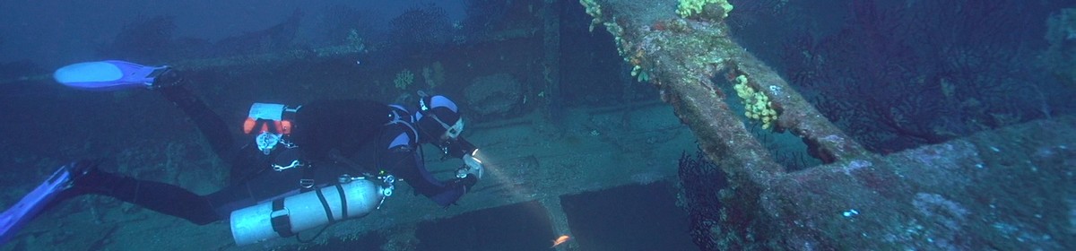
Impressive, but easy to dive wreck at the Mega Pier of Willemstad
Data & Description
Rating¹:

Difficulty²:

Type of vessel:
Cargo ship
Last cargo:
Blue jeans, cotton shirts and whiskey bottles
Length:
70 meters
Sunk:
September 1977
Reason sunk:
due to heavy seas, the badly secured cargo slipped
Minimum depth:
22 meters
Maximum depth:
34 meters
Local dive center:
Curaçao Divers
Route planner:
Google Maps
Weather:
Contributed by:
Martin Sebald, Carsten Richter, Michael Haker
Last content update:
2008/04/21
¹ Dive site rating: The rating is a five star rating ("poor" to "outstanding") and based on the dive site itself and on the comparison of all dive sites in the area. It also reflects the personal opinion and preference of the contributor.
² Dive site difficulty: The difficulty rating is a five star rating ("beginner" to "technical diver") and based on the personal opinion of the contributor and maybe also on the experience the contributor had when diving this site. We take absolutly no responsibility for diving accidents or anything else. Please always be a safe diver and dive your level of experience and please also be aware of local laws and regulations there might be.